|
|
 |

|
|
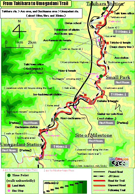
About 18km, About 5.5hrs.: From Takihara Station to Umegadani Station
--- a little hard walk |
|
|
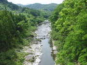
In most of this trail you walk on paved road along "Ouchiyama-gawa
River" through small villages. There is no pass in this trail, but
you can enjoy beautiful river scenery and Japanese-style houses.
Formerly there is trail both side of the river prepared for river swelling.
Some of them disappeared and other is succeeded to Route 42. |
| "From Takihara to Umegadani trail" brief Map |
|
 click a map and you can see a big PDF map for printing click a map and you can see a big PDF map for printing |
|
| Takihara Station ->(slight uphill and downhill, paved road, 110mins.)-> Small Park ->(almost even, paved road, 120mins.)-> Site of Milestone ->(slight uphill, paved road, 90mins.)-> Umegatani Station |
|
|
| by car |
Nagoya ==(Highway / 2hrs. and 10mins.)== Takihara Station ==(Route42 /
10mins.)== Ise-kashiwazaki Station ==(Route42 / 10mins.)== Umegatani Station |
| by train |
Nagoya Station ==(Nanki Express / 1hrs. and 35mins.)== Misedani Station
==(Local/5mins.)== TakiharaStation ==(Local/5mins.)== Aso Station ==(Local/10mins.)==
Ise-kashiwazaki Station ==(Local/5mins.)== Ouchiyama Station ==(Local/5mins.)==
Umegatani Station |
|
|
|
 |