|
|
 |

|
|
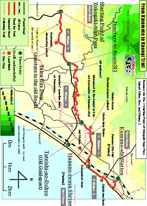
About 10km, About 3hrs. and 30mins.: From Kumano-shi Station to Arii Station
--- easy walk |
|
|
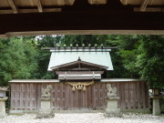
After walking over Matsumoto-toge Pass and getting to Hanano-iwaya Shrine,
pilgrims separated into two groups. One went toward Hongu-taisha Shrine
through "Hongu-do", the other went toward Hayatama-taisha Shrine
through "Hamakaido Road". This path is the starting point of
"Hongu-do."
There is no old road in this trail. But there are still stone statue of
jizo, stone monument and old guidepost.
Easy hiking trail with gentle uphill and downhill. |
| "From Kinomoto to Konogi path trail" brief Map |
|
 click a map and you can see a big PDF map for printing click a map and you can see a big PDF map for printing |
|
| Kumano-shi Station ->(even, paved road, 40mins.)-> Hanano-iwaya Shrine ->(even, paved road, 40mins.)-> Taira Bus Stop ->(uphill and downhill, paved road, 80mins.)-> Juncture to Route311 ->(downhill and uphill, paved road , 40mins.)-> Starting Point of Yokogaki-toge Pass |
|
|
| by car |
Nagoya ==(Highway & Route 42 / 4hrs.)== Kumano-shi Station ==(Route42/5mins.)==
Hanano-iwaya Shrine ==(Route42 & 311/15mins.)== Starting Point of Yokogaki-toge
Pass |
| by train and bus |
Nagoya Station ==(Nanki Express / 2hrs. and 50mins.)== Kumano-shi Station
==(Local Bus / 20mins.)== Kumano-shi Station |
|
|
|
 |